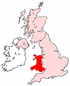
Llandrindod Wells Maps - District Map Llandrindod Wells Wales
Useful road map of Llandrindod Wells district, town centre and surroundings.
View Larger Map |
||
 |
||
Local District Street Map for Llandrindod Wells Powys Wales
Llandrindod Wells Maps: With this easy to print map, you can see local districts of Llandrindod Wells, its central area and surroundings within the county of Powys, Wales in the United Kingdom. Using this detailed Llandrindod Wells map, you can find your way around the town and locate streets, roads and facilities in Llandrindod Wells. The view of the map shown on this page is of the town centre area of Llandrindod Wells, use the minus ( - ) button (bottom right of map) to view districts and surrounding areas, villages, towns and points of interest. Llandrindod Wells district map. By viewing this map you can judge roughly how far Llandrindod Wells is from these nearby places and see the distance between.
Things you can view include: Rock Park International Bowling Greens, Llandrindod Wells Police Station, Llandrindod Wells Jobcentre Plus, The Hampton Hotel, Ridgebourne, Llandrindod Wells High Street, New Life Church, Powys College Llandrindod Wells, Llandrindod Wells Spa Town Trust, Portland House Bed and Breakfast, The National Cycle Collection Museum, Llandrindod Wells Train Station (Railway Station), Llandrindod Wells Pavilion, Llanyre, Llandrindod Wells Library, The Rock Park Spa Centre, Llandrindod Wells Tourist Information Centre, Rock Park Health Centre, Dolberthog Wood, The River Ithon, Lletty Cottage Covert, Arlais Brook, Nant-y-groes, Llandrindod Wells Hospital and County War Memorial and more (you may need to utilise "view larger map link").
Wales Maps: Llandrindod Wells, Powys street map. Printable map of Llandrindod Wells Wales.
Llandrindod Wells districts, Llandrindod Wells streets, Llandrindod Wells roads, Llandrindod Wells attractions.
More Local District Maps:
- Detailed Map Blaenavon District Wales
- Detailed Map Ruthin District Wales
- Detailed Map Bethesda District Wales
- Detailed Map Rhymney District Wales
- Detailed Map Senghenydd District Wales
Maps of Northern Ireland - Maps of England - Maps of Ireland